
When accuracy matters and projects require reliable results the first time, our team of surveyors excels. Siegfried delivers detailed surveys you can build upon by using the advanced capabilities of GPS and TPS combined with the human insight and experience needed to apply these tools.
From aerial and field surveys to boundary resolution and legal descriptions, our range of surveying capabilities provides clients with a significant depth of experience and expertise. We also have experience with underground utility and mechanical detection surveys, record surveys, and tree surveys.
The direct link to Siegfried’s field crews streamlines our design process and ensures accurate results by delivering a constant flow of communication between the survey crew in the field and designers and engineers in our offices. For our clients, having an exact picture of the existing conditions will allow our team to provide specific solutions tailored to their project.

Kevin Genasci
PLS
PLS
Survey Manager, Principal
Kevin’s clients benefit from his extensive experience in both the field and office. He specializes in surveys to support the design of residential subdivisions, commercial site developments, industrial site developments, and municipal infrastructure projects.
His expertise includes topographic surveying and mapping, boundary surveying, construction surveying, site development, and municipal infrastructure design support.
Kevin provides the big picture strategy, planning, and execution for the land surveying team and is responsible for the direction and supervision of the survey crews on his project assignments.
Education
Agricultural Systems Management
California Polytechnic State University
San Luis Obispo, CA
License
California Land Surveyor
License No. 8660
Kevin’s Featured Projects
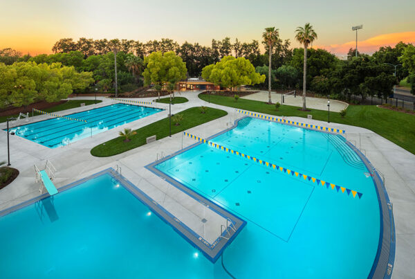
UC Davis, Aquatics & Recreational Pool Renovation – Davis, CA LEED Gold
UC Davis, International Center - Davis, CA
UC Davis, Student Community Center - Davis, CA
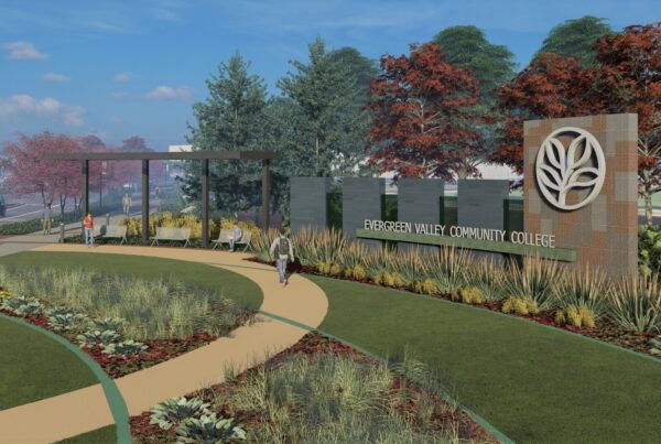
Evergreen Valley Community College, Language Arts Building - San Jose, CA
Evergreen Valley Community College, Fire Lane - San Jose, CA
Evergreen Valley Community College, General Education Building - San Jose, CA
Evergreen Valley Community College, Entry Road & Parking Lot - San Jose, CA
San Jose City College, Career Technical Education Complex - San Jose, CA
UC Santa Cruz, Upper Quarry Amphitheater Renovation – Santa Cruz, CA LEED Silver
William Overfelt High School, Music, Art, and Administration Building & Quad Modernization – San Jose, CA
Yerba Buena High School, Student Union & Quad Transformation – San Jose, CA
El Camino Fundamental High, Center for Performing Arts – Sacramento, CA
Casa Roble High School, Student Union & Career Technical Education Building – Orangevale, CA
UC Davis Health, California Tower – Sacramento, CA
UC Davis Health, Ernest T. Tschannen Eye Institute – Sacramento, CA
UC Davis Health, Sacramento (48x) Ambulatory Surgery Center - Sacramento, CA
UC Davis Health, Parking Structure 4 – Sacramento, CA
UC Davis Health, Parking Structure 5 - Sacramento, CA
California Department of Corrections & Rehabilitation, California Healthcare Facility - Stockton, CA
San Joaquin General Hospital, Acute Care Wing - French Camp, CA
City of Stockton, Miner Avenue Complete Streets – Stockton, CA
City of Stockton, Main Street Complete Streets – Stockton, CA
City of Stockton, California Street Road Diet – Stockton, CA
Amazon Fulfillment Center – Sacramento, CA
Amazon Fulfillment Center – Stockton, CA
City of Stockton, Airport Gateway – Stockton, CA
City of Lathrop, Lathrop Gateway – Lathrop, CA
Markets
Commercial
Commercial Private Development
Cultural
Entertainment
Government
Institutional
Fortune 500 Industrial
Higher Education
Hospitality
Healthcare
Mixed-use/Retail
Parking Structures
Public Assembly
Long-Span
Manufacturing
Residential Private Development
Transportation
Public Works
Tall Buildings
Services
Surveying
ALTA/ACSM Surveys
Boundary Surveys
Cadastral Surveys
Geodetic/Control Surveys
GPS Surveys
Hydrographic Surveys
Topographic Surveys
Right-of-way Surveys
Volumetric Surveys
Controls for Aerial Photogrammetry
Construction Staking
Subdivision Maps
Lot Line Adjustments
Mapping
Parcel Maps
Public Lands Surveys
Record of Survey Maps
Utility Mapping
Additional Services
Elevation Certificates
Expert Witness Services
GIS Level Mapping
Project Delivery Experience
Design-Build (DB)
Design Bid Build (DBB)
Integrated Project (IPD)
Public-Private-Partnership (3P)
Construction Manager at Risk (CMAR)